Group Members
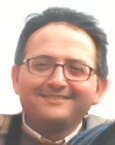
Dr. Josep E. Pardo Pascual
Professor – Director CGAT
Dr. Josep E. Pardo-Pascual teaches environmental dynamics, and environmental characterization through the application of cartographic techniques: Geomorphology, LiDAR data management, Environmental application of Digital Terrain Models, Littoral Processes and Human action. Since 1999 he has been head of the Geo-environmental Cartography and Remote Sensing (CGAT) research group.
His research is focused on coastal geomorphology, especially beach changes, beach-dune interactions and lagoon morphology, human action, and use of new cartographic tools and data (especially satellite imagery) to improve knowledge about coastal changes. However, he also has been working on Quaternary evolution of coastal landscapes.
Email: jepardo @ cgf.upv.es
Phone: +34 963877000 (75537)
Background
M.Sc Geography – Universitat de València
PhD Physical Geography – Universitat de València
Research Interests
- Changes in fluvial landscapes
- Relationship between karst and tectonics processes
- Automated generalization cartography processes
- Remote sensing applications on urban areas
Ongoing Research
- Coastline changes from remote sensing
- 3D beach changes using LiDAR and photogrammetry
Publications
See Publications
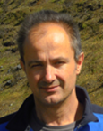
Dr. Luis A. Ruiz
Professor – Co-director CGAT
Dr. Luis A. Ruiz teaches remote sensing and digital image processing at UPV (Dept. Cartographic Engineering, Geodesy and Photogrammetry), he is a regular visiting lecturer at Karlsruhe University of Applied Sciences, and has been a visiting researcher at LARSE (OSU), RSGAL (UW), USFS Missoula Fire Sciences and Pacific Wildland Fire Sciences labs. Since 2013 he is editor in chief of the Spanish Journal of Remote Sensing, and since 2022 president of the Spanish Association of Remote Sensing.
His research focuses on LULC classification and change detection using object-oriented image analysis; LiDAR methods and applications in forest structure, attribute estimation and mapping; and the relation of LULC fragmentation metrics and socio-economic variables for the characterization of urban areas. He is currently involved in projects FireMode, GeoTAK, GeoCLIC, UN4DRR and RiceMon.
Email: laruiz @ cgf.upv.es
Phone: +34 963877000 (75536)
Background
BSc & M.Sc Agricultural Engineering – Universidad Politécnica de Madrid
PhD Agricultural Engineering – Universitat Politècnica de València
Research Interests
- Land use/land cover change analysis
- Object-based feature extraction and classification
- Remote sensing and LiDAR in forestry and agriculture
- Landscape fragmentation metrics
Ongoing Research
- Analysis and mapping of forest structure and fuel variables from discrete and full-waveform LiDAR data
- Exploring multitemporal urban land use fragmentation metrics and its relationship with socio-economic variables
- Aplication of object-based classification methods for LULC geodatabase updating
Publications
See Publications
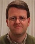
Dr. Ángel Balaguer Besser
Assoc. Professor
Dr. Angel Balaguer-Beser teaches courses in the degree in Geomatic and Surveying Engineering and in the Master in Geomatic and Geoinformation at Polytechnic University of Valencia (Dept. of applied mathematics). His research focuses on the design of new non-linear high-order interpolation methods for the numerical simulation of bed-load sediment transport process due to the movement of a fluid over a sediment layer.
He also investigates in subpixel edge detection problems of image interpolation. He works in the definition of a new set of texture semivariogram features for object-oriented image classification. He is also participating in the research related to the computing of the shoreline position deduced from Landsat imagery.
He is currently involved in projects FIRMACARTO and transport of sediments
Email: abalague @ mat.upv.es
Phone: +34 963877000 (86651)
Background
BSc & M.Sc Mathematics sciences, Universitat de Valencia.
PhD – Mathematics sciences, Universitat Jaume I.
Research Interests
- Numerical simulation of sediment transport processes
- High-order interpolation methods for image analysis
- Modelling of beach and fluvial systems
- Regression methods to predict forest structure variables
Ongoing Research
- Numerical-experimental modelling of local scouring downstream of protected bridges in alluvial river beds
- Analysis of the shoreline position extracted from Landsat imagery
- Statistical methods for the estimation of forest structure variables
- Description of a new set of object-based temporal geostatistical features for land-user change detection
Publications
See Publications

Dr. Alfonso Fernández Sarría
Assoc. Professor
Dr. Alfonso Fernández Sarría teaches Remote Sensing and Geomorphology at UPV (Dept. Cartographic Engineering, Geodesy and Photogrammetry). His research is focused on the extraction of forest variables from airborne LiDAR data for forest inventory, discrimination and quantification of biomass, etc.
In the agricultural sector, he is working on potential applications of ALS and TLS data to the field of precision agriculture and their combination with data extracted from automatized digital photogrammetry. Modeling of sand dunes and coastal areas from 3D and multispectral data and their morphological changes is another line of work.
He is currently involved in projects FIRMACARTO and RESETOCOAST
Email: afernan @ cgf.upv.es
Phone: +34 963877000 (75573)
Background
Technical Surveying Engineer – Universitat Politècnica de València.
Engineer in Geodesy and Cartography – Universitat Politècnica de València.
PhD Engineer in Geodesy, Cartography and Geographical Information Systems – Universitat Politècnica de València.
Research Interests
- Terrestrial Laser Scanner (TLS) applied to forestry and agriculture
- Multispectral remote sensing for coastal areas
- Three-dimensional modeling using automated photogrammetry and Structure from Motion (SfM)
- Remote sensing and LiDAR in forestry and agriculture
Ongoing Research
- Analysis and mapping of forest structure and fuel variables from Terrestrial Laser Scanner data
- Multispectral remote sensing in coastal areas to obtain bathymetry
- Analysis of the geometry of fruit trees (olives and almonds) using TLS and digital photogrammetry equipment
Publications
See Publications
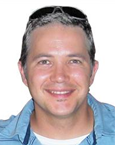
Dr. Jesús Manuel Palomar Vázquez
Assoc. Professor
Dr. Jesús Palomar Vázquez teaches GIS, Programming (especially Python) and 3D visualization at UPV (Dept. Cartographic Engineering, Geodesy and Photogrammetry). Currently, his main research line is focused on automated extraction and analysis of shorelines from LANDSAT and SENTINEL-2 imagery.
He has also worked in automatic cartographic representation and generalization, mobile cartography and 3D data acquisition, visualization and modelling for documentation heritage purposes.
He is currently involved in RESETOCOAST project
Email: jpalomav @ upvnet.upv.es
Phone: +34 963877000 (75563)
Background
Technical Surveying Engineer – Universitat Politècnica de València.
Engineer in Geodesy and Cartography – Universitat Politècnica de València.
PhD Engineer in Geodesy, Cartography and Geographical Information Systems – Universitat Politècnica de València.
Research Interests
- Extraction of shorelines from Image processing
- GIS programming
- Cartographic generalization
- Acquisition and dissemination of 3D heritage models through web frameworks
Ongoing Research
- Methods to extract shorelines from LANDSAT and SENTINEL-2 imagery (RESETOCOAST national project)
- Combination of 2D and 3D information for heritage documentation improvement
Publications
See Publications
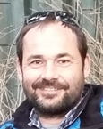
Dr. Jorge Recio Recio
Assoc. Professor
Dr. Jorge A. Recio teaches remote sensing, digital image processing and GIS at UPV (Dept. Cartographic Engineering, Geodesy and Photogrammetry), and has been a visiting researcher at Institut für Photogrammetrie und GeoInformation (Leibniz Universität Hannover).
His research focuses on LULC classification and change detection using object-oriented image analysis; update of spatial database, LiDAR methods and applications in forest structure, attribute estimation and mapping.
He is currently involved in project FIRMACARTO.
Email: jrecio @ cgf.upv.es
Phone: +34 963877000 (79553)
Background
B.Sc. Surveying Engineering – Universitat Politècnica de València
M.Sc. Geodetic & Cartographical Engineering– Universitat Politècnica de València
Ph.D. in Geodesy, Cartography and GIS.– Universitat Politècnica de València
Research Interests
- Land use/land cover change analysis
- Object-based image analysis
- Update of spatial databases
- Remote sensing and LiDAR in forestry and agriculture
Ongoing Research
- Application of object-based classification methods for LULC geodatabase updating
- Design of multitemporal descriptive features to detect environmental changes
- Analysis and mapping of forest structure and fuel variables from discrete and full-waveform LiDAR data
Publications
See Publications
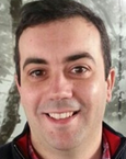
Dr. Javier Estornell Cremades
Assoc. Professor
Dr. Javier Estornell teaches remote sensing and GIS in the Universitat Politècnica de València (Campus of Gandia) and belongs to the GeoEnvironmental Cartography and Remote Sensing group (CGAT). Since 2014, he is assistant editor of the Spanish Journal of Remote Sensing. His research interests focus on the application of LiDAR data and satellite images in agriculture, forestry, and coast studies.
Email: jaescre @ cgf.upv.es
Phone: +34 962849324
Background
BS degree in Geodesy and Cartography Engineering – Universitat Politècnica de València (Spain)
PhD in Geodesy, Cartography, and Geographical Information Systems – Universitat Politècnica de València (Spain)
Research Interests
- Remote sensing and LiDAR in forestry, agriculture and coast studies
- Land use/land cover change analysis
- Terrestrial Laser Scanner in agriculture and forestry
Ongoing Research
- Estimation of direct and indirect parameters of fruit trees using terrestrial and airborne LiDAR data
- Analysis and mapping of dunes from airborne LiDAR data
- Study of forest structure variables using airborne LiDAR data
Publications
See Publications
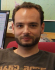
Dr. Jaime Almonacid Caballer
Post doc researcher – CGAT
Dr. Jaime Almonacid-Caballer has developed the main part of his career in the Dept. Cartographic Engineering, Geodesy and Photogrammetry. Where he obtained the PhD in December of 2014. His Bachelor and PhD Thesis are related to coastal management, concretely on the subpixel automated coastline extraction from Landsat imagery, which includes automated georreferenciation, evaluation and analysis derived from those lines.
Other works have been related with the development of a low cost aerial photogrammetric tools, the mathematical co-development of terrestrial photogrammetric constraints oriented to coastal management.
He worked with point clouds derived both from Photogrammetric techniques and LiDAR to obtain derived products needed for the coastal managements (DTMs, DSMs etc). He also co-worked in the development of LiDAR tools in ENVI/IDL.
During 2016 he worked as Quality Control manager in the LiDAR group of Aerodata International Surveys placed in Utrecht (The netherlands). After getting into the LiDAR processing workflow (mainly developed with RiEGL systems/software and TerraScan) he was responsible of the Quality of the delivered data and on fixing any complaint from older deliveries. He was in charge on finding simpler and faster ways to improve the workflow. As a matter of research, he was in charge of spreading the point of view to detect automatically any geometric problem (mainly working with Tie Lines and vertical surface mismatches) trying always to work with freeware and simple but usable tools.
Nowadays he is developing he is part of the CGAT team in charge of spreading the sub-pixel coastline detection he developed in his PhD to be useful for new SENTINEL platform and updating the algorithms to reach new precision levels.
Email: jaime.almonacid.caballer @ gmail.com
Background
Technical Engineering in Surveying – Universitat Politècnica de València
Engineering in Cartography and Geodesy – Universitat Politècnica de València
PhD Cartography – Universitat Politècnica de València
Research Interests
- Subpixel/hiper-resolution processes
- Coastal management tools
- 3D point cloud management
- Spreading of the remote sensing knowledge to non-expert environments
- Bathymetry via Landsat
Ongoing Research
- Big data of coast lines management
- Multitemporal coastlines analysis
Publications
See Publications
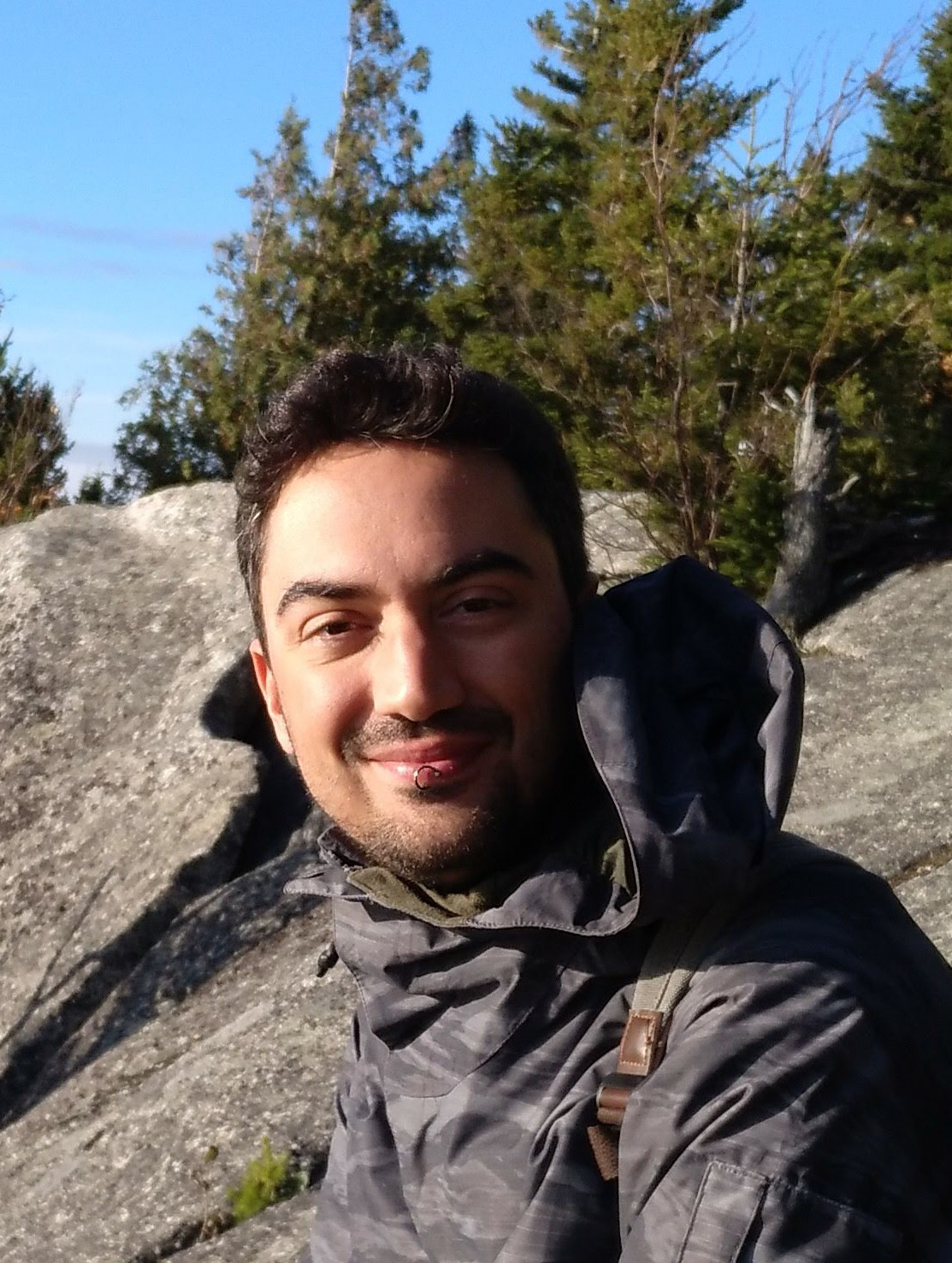
Dr. Pablo Crespo Peremarch
Post doc researcher
Dr. Pablo Crespo Peremarch works in the CGAT as technical researcher since November 2014. In September 2020, he successfully defended his PhD in Geomatics Engineering with a grade of Excellent and the Cum Laude award, as well as the International Doctorate mention.
Dr. Pablo Crespo Peremarch is currently involved in different projects to use remote sensing for forestry and agricultural purposes. He is working on the characterization of the forest structure in different ecosystems by using different sources of laser scanning data (i.e., discrete airborne, terrestrial and unmanned laser scanning, full-waveform airborne laser scanning, and spaceborne laser scanning: GEDI). On the other hand, he is also working on the classification of crop types through convolutional and recurrent neural network methods using high-resolution and Sentinel-1 and 2 imageries as input data.
In addition, he has recently been involved in the MAIL project about the identification of Marginal Lands in Europe in a CO2 sequestration strategy. In this project he has developed a tool in Google Earth Engine to estimate the evolution of CO2 in Marginal Lands along time in the whole of Europe.
Dr. Pablo Crespo Peremarch is currently involved in PAC-2021, MAIL and UN4DRR projects, and he has also been involved in NEXUS, PAC-2020, FIRMACARTO and ForeStructure projects.
Email: pabcrepe @ cgf.upv.es
Phone: +34 963877160 (75576)
Background
Technical Surveying Engineer – Universitat Politècnica de València
Engineer in Geodesy and Cartography – Universitat Politècnica de València
Master’s Degree in Software Engineering, Formal Methods and Information Systems – Universitat Politècnica de València
PhD in Geomatics Engineering – Universitat Politècnica de València
Research Interests
- Remote sensing for forestry and agricultural purposes
- Characterization of forest structure through laser scanning configurations
- Machine learning
Ongoing Research
- Use of remote sensing and deep learning to classify crop types
- Characterization of forest structure in different ecosystems by using different laser scanning configurations
- Estimation of CO2 evolution along time in Marginal Lands in Europe
Publications
See Publications
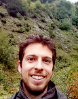
Dr. Carlos Cabezas Rabadán
Post doc researcher
Dr. Carlos Cabezas works in the CGAT as researcher since September 2016. In March 2021, he completed his PhD “Beach Morphology and its Dynamism from Remote Sensing for Coastal Management Support” with a grade of Excellent and the Cum Laude award, as well as the International Doctorate mention.
He is currently carrying out his research in collaboration with the UMR EPOC at Université de Bordeaux-CNRS applying remote sensing techniques for the characterization of the coast and the beaches in order to support decision-making process. Different methodologies have been proposed to characterise the beach morphology, mainly using mid-resolution optical imagery and always with the aim of improving the comprehension of coastal processes and the management of these spaces.
Nowadays he is leading the project PAID-06 that aims to monitor the shoreline response to erosive events and, he is collaborating at the Spanish project MONOBESAT that attempts a morphological monitoring of beaches, the European project ECFAS to create a proof-of-concept for the implementation of a European Copernicus coastal flood awareness system, and the regional project SIMONPLA to develop a coastal monitoring system.
In parallel to his research, during the last years he has been teaching geomorphology, GIS and environmental impact assessment.
Email: carcara4 @ upv.es
Phone: +34 963877160 (75576)
Background
Bachelor’s Degree in Environmental Sciences (Universitat Politècnica de València)
Master’s Degree in in Assessment and Environmental Monitoring of Marine and Coastal Ecosystems (Universitat Politècnica de València)
Master’s Degree in Environmental and Territorial Management Techniques (Universitat de València)
PhD in Geomatics Engineering (Universitat de València)
Research Interests
- Shoreline changes
- Integrated coastal zone management
- Environmental impact
- Sustainable beach management
Ongoing Research
- Beach morphological changes from satellite imagery.
- Coastal management.
- Water fluctuations wetlands.
Publications
See Publications
+ LinkedIn
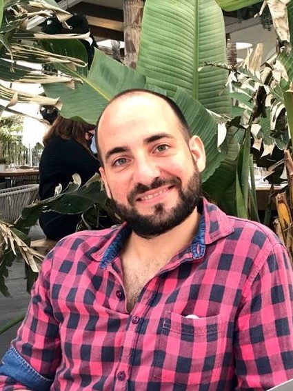
Jesús Torralba Pérez
PhD Student in Geomatics Engineering
Jesús Torralba is a PhD student in Geomatics Engineering at UPV. His research is focused on characterisation of forest structure and forest fuel by integrated analysis of methods based on Terrestrial Laser Scanning (TLS) and imagery.
He is involved in FIRMACARTO research project.
Email: jetorpe @ upv.es
Phone: +34 963877160 (75576)
Background
Bachelor of Engineering in Forestry and Natural Environment (Universidad de Castilla-La Mancha, España)
Diploma in Geomatics and Satellite Technology (Universidad Mayor, Chile)
Master of Science in Remote Sensing (Universidad Mayor, Chile)
Research Interests
- Remote sensing in forestry and natural environment
- Generation of models to estimate forest structure and fuel variables
- Analysis and mapping of forest dynamics
- Land cover change analysis
Ongoing Research
- Improvement of the characterization of forest structure in Mediterranean forest through the incorporation and analysis of Terrestrial Laser Scanning (TLS).
Others
See Publications
+ LinkedIn
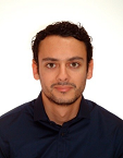
Juan Pedro Carbonell Rivera
PhD Student in Geomatics Engineering
Juan Pedro Carbonell Rivera is a PhD student in Geomatics Engineering at UPV with a predoctoral contract granted by the Spanish Ministry of Science, Innovation and Universities, since September 2018. His research is focused on characterisation of forest structure by integrated analysis of methods based on Unmanned Aerial Vehicle (UAV) derived imagery.
He is currently involved in project FIRMACARTO.
Email: juacarri @ upv.es
Phone: +34 963877160 (75576)
Background
Bachelor’s Degree in Engineering in Geomatics and Topography (Universitat Politècnica de València)
Master’s Degree in Geomatics Engineering and Geoinformation (Universitat Politècnica de València)
International Master’s Degree in Geomatics (Karlsruhe University of Applied Sciences)
Research Interests
- Forest structure characterization from remote sensing imagery.
- Generation of models to estimate fuel mass and forest structure.
- Multi-temporal analysis and quantification of forest variables.
- Software development for forest inventory estimation.
- Modelling forest carbon cycle.
Ongoing Research
- Characterization of the forest structure in Mediterranean forests through the study and analysis of high resolution image processing methodologies at different scales.
- Use and analysis of geomatics techniques applied for the generation of carbon estimation models.
Others
See Publications
+ LinkedIn
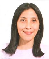
María Alicia Arcos Villacís
PhD Student in Geomatics Engineering
María Alicia Arcos Villacís is a PhD student in Geomatics Engineering with a predoctoral contract granted by the Universitat Politècnica de València (Subprogram 1, PAID-01-19), since May 2020. She is carrying out her PhD thesis at CGAT group at the UPV. Her research is focused on modeling and mapping live fuel moisture content in the Comunitat Valenciana.
Email: maar12m @ doctor.upv.es
Phone: +34 963877160 (75576)
Background
Bachelor’s Degree in Geographic and Environmental Engineering (Universidad de las Fuerzas Armadas-ESPE, Sangolquí – Ecuador)
Master’s Degree in Geomatics Engineering and Geoinformation (Universitat Politècnica de València)
Research Interests
- Analysis of the incidence of the moisture content of live fuel in the evaluation of the risk of forest fire.
- Relationship between live fuel moisture with spectral indices and meteorological data.
- Multitemporal analysis of meteorological variables in the Valencian Community forest areas.
- Characterization of the forest structure of Mediterranean forests.
Ongoing Research
- Estimation of the moisture content of live fuel in Mediterranean forests, shrubs and shrubs using Sentinel-2 images.
- Construction of precise and robust LFMC models from forest plots.
- Modelling live fuel moisture content for wildfire risk evaluation and mapping in the Valencian Community forest areas.
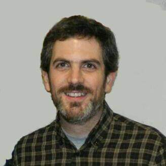
Juan Jose Valero Fernández
Researcher
Juan Jose Valero Fernández works in the CGAT as researcher since January 2021. His research focuses on the automated extraction of coastlines and their analysis from Landsat and Sentinel-2 satellite images.
Email: juavafer @ upv.edu.es
Phone: +34 963877160 (75576)
Background
Technical Engineering in Surveying (Universitat Politècnica de València)
Engineering in Cartography and Geodesy (Universitat Politècnica de València)
Master’s Degree in Remote Sensing (Universitat de València)
Research Interests
- Extraction of shorelines from Image processing.
- Shoreline changes.
Ongoing Research
- Coastline extraction.
- Multitemporal coastlines analysis.
Javier Álvaro Quille Mamani
PhD Student in Geomatics Engineering
Javier Álvaro Quille Mamani is a PhD student in Geomatics Engineering with a scholarship (The Bicentennial Generation) from the Peruvian government for the completion of the thesis (Programa Nacional de Becas y Crédito Educativo (PRONABEC) of the Peruvian Ministry of Education (MINEDU)), since September 2021.
His research focuses on the estimation of crop variables and agricultural productivity in arable crops from multispectral satellite images and unmanned aerial vehicles (UAV).
Email: jaquille @ doctor.upv.es
Phone: +34 678761668
Background
Degree of Agronomist Engineer (Universidad Nacional Jorge Basadre, Peru)
Master’s Degree in Water Resources (Universidad Nacional Agraria La Molina, Peru)
Research Interests
- Multitemporal analysis of agricultural coverages from remote sensing images.
- Generation of models to estimate crop biometric variables.
- Model generation for evapotranspiration and Crop Water Stress Index (CWSI).
Ongoing Research
- Biomass and yield estimation using phenological metrics from Sentinel-2 imagery in rice cultivation.
Ausiàs Roch Talens
PhD Student in Geomatics Engineering
Ausiàs Roch Talens is a PhD student in Geomatics Engineering at UPV with a predoctoral contract granted by the European Commission since December 2021. His research is focused on a proof-of-concept for the implementation of a European Copernicus Coastal Flood Awareness System.
Email: aurocta @ cgf.upv.es
Phone: +34 963877160 (75576)
Background
Bachelor’s Degree in Engineering in Geomatics and Topography (Universitat Politècnica de València)
Master’s Degree in Remote Sensing (Universitat de València)
Research Interests
- Satellite based bathymetry.
- Implementation of a coastal awareness system.
- Coastal erosion.
Marina Simó Martí
PhD Student in Geomatics Engineering
Marina Simó Martí is a PhD student in Geomatics Engineering at UPV with a predoctoral contract granted by the Spanish Ministry of Science and Innovation (FPI grant), since September 2022. Her research is focused on the 3D-structural cartography of Mediterranean forests as input for fire behavior models. She is currently involved in the FireMode project.
Email: msimmar @ doctor.upv.es
Phone: +34 963877160 (75576)
Background
Bachelor’s Degree in Environmental Science (Universitat de València) with BsD Special Award
Master’s Degree in Remote Sensing (Universitat de València) with MsD Special Award
Research Interests
- Use of remote sensing for forestry applications.
- Wildfire dynamics modelling.
- Multi-temporal analysis of terrestrial ecosystem variables and vegetation indices.
- LiDAR.
Ongoing Research
- Optimization and adaptation of data and biofuel variables obtained from laser scanning sensors for their input in physical 3D fire behavior models.
- Analysis of the effect of 3D fragmentation of forest structure, species composition and fuel moisture content in wildland fire dynamics.

Dr. Denys Gorkovchuk
PhD Researcher
Dr. Denys Gorkovchuk worked as associated professor at Kyiv National University of Construction and Architecture at Department of Geoinformatics and photogrammetry. The head developer of VRscan3D – virtual simulator of terrestrial laser scanner. One of the founders and Technical director of SPM3D LLC.
His research is focused on close-range and aerial photogrammetry applications in construction, architecture and cultural heritage, use of laser scanning for solving practical tasks, techniques of improving the accuracy and quality of low-cost sensors.
Email: dgorkov1 @ cgf.upv.es
Phone: +34 615793863
Background
M.Sc in Geographic information systems – Kyiv National University of Construction and Architecture
PhD in Geodesy, photogrammetry and cartography – Kyiv National University of Construction and Architecture
Research Interests
- Use of photogrammetry and laser scanning in cultural heritage preservation.
- Low-cost and close-range photogrammetry.
Ongoing Research
- VRscan3D – virtual simulator of terrestrial laser scanner.
- 3D beach changes using LiDAR and photogrammetry.

Dr. Iuliia Horkovchuk
PhD Researcher
Dr. Iuliia Horkovchuk worked from 2010 till 2022 as associated professor at Geoinformatics and photogrammetry department of Kyiv National University of Construction and Architecture. Deputy dean of the Faculty of Geoinformation systems and territorial management KNUCA. From 2019 till 2022 coordinated the DAAD project Development of a virtual environment for learning technologies for digitalization of the world VirScan3D” in Ukraine. Founder and General Manager of SPM3D LLC.
Her research is focused on spatial analysis, geoinformation modelling, photogrammetric measurement methods, high-precision laser scanning, the latest approaches to learning, including VR and AR.
Email: ihorkov @ cgf.upv.es
Phone: +34 643906033
Background
M.Sc in Geographic information systems – Kharkiv National Academy of city economy
PhD in Cadaster and Land Management – Kyiv National University of Construction and Architecture
Research Interests
- Use of photogrammetry and laser scanning in cultural heritage preservation.
- Modern learning approaches using VR and AR.
Ongoing Research
- VRscan3D – virtual simulator of terrestrial laser scanner.
- Analysis and mapping of forest structure and fuel variables from discrete and full-waveform LiDAR data.
Collaborators
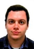
Roberto Edo Botella
Researcher
Roberto Edo Botella works in the CGAT as technical researcher since November 2021. His research is focused on the evaluation of the moisture content of live fuels in the forest masses of the Comunidad Valenciana for the creation of models and mapping of the moisture of live fuel.
Email: roedbo @ cgf.upv.es
Phone: +34 963877160 (75576)
Background
Graduate of Engineering in Forestry and Natural Environment (Universidad Politécnica de Valencia)
Master in Forest Engineering (Universidad Politécnica de Valencia)
Research Interests
- Fire behavior models for the prevention and extinction of forest fires.
- Analysis of the evolution of forest fires.
- Prevention measures against forest fires.
Ongoing Research
- Estimate of the moisture content of the live fuel of the forest masses of the Comunidad Valenciana using Sentinel-2 data.
Others
See LinkedIn

Elena Sánchez García
Post doc researcher
Dr. Elena Sánchez García is a PostDoctoral Scientist working on the development of techniques for globally monitoring air quality and the emissions of gases into the atmosphere measurements from different multispectral and hyperspectral satellite missions. Her research is being combined with teaching hours in Mathematics and Physics at the UPV.
At the CGAT she worked on the development of techniques for shoreline detection and other coastal indicators through image processing and remote sensing. Indeed, as part of her Ph.D she was immersed in the development of SHOREX and C-Pro tools and other projects working with Surfcam online streaming cameras and the CoastSnap initiative using crowd-sourced smartphone images. In 2019 she defended her PhD “Photogrammetry and image processing techniques for beach monitoring” with a grade of Excellent and the Cum Laude award, as well as the International Doctorate mention.
Email: elena.sanchez.upv @ gmail.com
Background
Technical Surveying Engineer (Universitat Politècnica de València)
Engineer in Geodesy and Cartography (Universitat Politècnica de València)
PhD in Mathematics (Universitat Politècnica de València)
Research Interests
- Global analysis of trace gases
- Development of techniques for shoreline detection and other coastal indicators
- Coastal video monitoring and forecast numerical models
Ongoing Research
- Mapping methane point emissions with multispectral and hyperspectral satellite missions
Publications
See Publications
+ LinkedIn
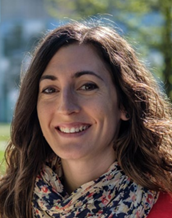
Dr. Marta Sapena Moll
Research scientist at the German Aerospace Center (DLR)
Dr. Marta Sapena worked for five years at CGAT (2014-2019). In 2020 she defended her PhD “Development and analysis of land-use/land-cover spatio-temporal metrics in urban environments: Exploring urban growth patterns and linkages to socio-economic factors” with a grade of Excellent and the Cum Laude award, as well as the International Doctorate mention.
At the CGAT she worked on the characterization of urban areas through the monitorization and modelling of urban dynamic studies, she developed methodologies that allow relating the spatial structure of urban areas to the evolution of geographic, demographic, and socio-economic variables, and was also involved in forest structure studies, such as forest fragmentation and object-based classification with low density LiDAR and high-resolution imagery to fuel strata.
Currently her main research focus is remote sensing for urban applications, combining spatial and statistical data and methods. She is working on spatio-temporal metrics for urban growth pattern characterization and their relationships with socio-economic factors, exposure and vulnerability of informally urbanized areas against landslides, and urban dynamic monitoring in different geographic context.
Email: martasapena @ gmail.com
Background
Technical Surveying Engineer (Universitat Politècnica de València)
Engineer in Geodesy and Cartography (Universitat Politècnica de València)
PhD in Geomatics Engineer (UPV & Universidad Politécnica de Madrid)
Research Interests
- Spatio-temporal metrics and links to socio-economic factors
- Urban risk assessment
- Urban growth and migration
Ongoing Research
- Population disaggregation (dasymetric and statistical methods)
- Multi-scale exposure and vulnerability assessment to landslides in Medellín, Colombia
- Identifying migration pathways using remote sensing in Western Africa
Publications
See Publications
+ ResearchGate

Dr. Txomin Hermosilla
Research scientist at the Canadian Forest Service, Victoria, British Columbia
Txomin Hermosilla worked in the CGAT between 2005 and 2012, as one of the original research members of the group. In 2011 he defended his PhD thesis entitled “Automatic building detection and land-use classification in urban environments with high spatial resolution imagery and LiDAR data”.
Within the CGAT his work was focused on integrating multiple-source remote-sensing data for automatic land-use/land-cover mapping agricultural, urban, and forest scenarios. Since 2012 Txomin works as post-doctoral research fellow in the Integrated Remote Sensing Studio of the University of British Columbia. His current project develops big-data methods for image compositing and time-series analyses of massive Landsat data for monitoring land cover and land-cover changes in Canada’s boreal forest.
Email: txominhermos @ gmail.com
Background
Technical Surveying Engineer (Universidad del País Vasco/Euskal Herriko Unibertsitatea)
Engineer in Geodesy and Cartography (Universitat Politècnica de València)
MSc in Geographical Information Management (Cranfield University)
PhD in Geodesy, Cartography and Geographical Information Systems (Universitat Politècnica de València)
Research Interests
- Time series analysis
- Land cover change analysis
- Big data computing
Ongoing Research
- National Terrestrial Ecosystem Monitoring System ( NTEMS )
Publications
See Publications on Mendeley

Dr. Jose Luis Gil
Quality Control of Seismic Navigation data and geodesy consultancy in Geograf AS, Norway
Jose Luis Gil started his career as part of the CGAT research group in the Dept. Cartographic Engineering, Geodesy and Photogrammetry. He has been awarded national and international awards for both Bachelor and Engineering (MSc) theses.
His research work within the group has been focused on forestry LiDAR studies and LU/LC object-based change detection using image processing and machine learning methods. His PhD was related to multitemporal object-based feature extraction using very high resolution images for LU/LC change detection.
He is currently working in the oil business performing geospatial Quality Control of Seismic Navigation data and geodesy consultancy in Geograf AS, Norway.
Email: jogiye @ gmail.com
Background
Technical Engineering in Surveying – Universitat Politècnica de València
Engineering in Cartography and Geodesy – Universitat Politècnica de València
PhD Student in Geographical Engineering – Universidad Politécnica de Madrid
Research Interests
- Object-based change detection
- Image processing
- Machine learning
- Feature extraction
- LiDAR
Ongoing Research
- LU/LC object-based change detection
- Multitemporal feature extraction
Publications
See Publications
+ Linkedin
Visiting Scholars
- Moudrý Vítězslav (Czech University of Life Sciences Prague, Czech Republic) [2022]
- Stefano Chiappini (Università Politecnica delle Marche, Italy) [2022]
- Paulina Raeva (Czech Technical University in Prague, Czech Republic) [2021]
- Diego Pacheco (Universidad del Azuay, Ecuador) [2019-2020-2023]
- Idania Briceño de Urbaneja (Universidad Mayor, Chile) [2018-2019]
- Soledad Represa (Universidad Nacional de La Plata, Argentina) [2017-2018/2018-2019]
- Waldo Pérez Martínez (Universidad Mayor, Chile) [2017-2018]
- David Roig Cervera (Centre for Marine and Renewable Energy, Cork, Ireland) [2015-2016]
- Tsolmon Renchin (National University of Mongolia) [2014-2015]
- Jorge Patiño (Universidad EAFIT, Medellín, Colombia) [2013]
- Natasha Piccone (Universidad Nacional del Sur, Tandil, Argentina) [2013]
- Mauro Novara (Universidad Nacional de La Patagonia, Comodoro Rivadavia, Argentina) [2011]
- Gerson Colmenárez (Universidad Centro Occidental Lisandro Alvarado, Barquisimeto, Venezuela) [2009-2013]


