SAET
Shoreline Analysis and Extraction Tool: open-source tool developed by CGAT researchers to enable the completely automatic extraction of the shoreline position at sub-pixel level by using the imagery acquired by the Sentinel-2 and Landsat 8 and 9 satellites. SAET has been developed within the ECFAS (European Coastal Flood Awareness System) project (https://www.ecfas.eu/). focusing on the monitoring of the shoreline position changes associated with punctual events such as coastal storms.The tool offers different settings to be adapted to the different coastal environments and beach typologies.
Files and documents:
The tool is available at Zenodo and GitHub
Palomar-Vázquez, J., Pardo-Pascual, J. E., Almonacid-Caballer, J., & Cabezas-Rabadán, C. 2023. Shoreline Analysis and Extraction Tool (SAET): A New Tool for the Automatic Extraction of Satellite-Derived Shorelines with Subpixel Accuracy. Remote Sensing, 15(12), 3198. Doi: 10.3390/rs15123198
The article presents the tool, its running modes and main settings, as well as an assessment of the resulting shorelines, and an example of usage for characterising the shoreline response to a storm event.
Explanatory video of the tool

FETEX v2.0
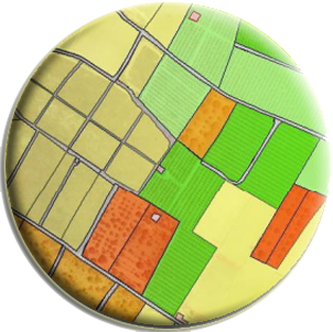
A feature extraction software tool for object-based image analysis, and it is designed to work with land use/land cover databases in order to help in the process of classification of the existing parcels, or also to determine the changes that have occurred in a database comparing the current classified image with the old database. It has been applied in the feature extraction phase in several updating land use/land cover cartography processes.
Descriptive documents:
In the following documents you will find a thorough description of the software, the type of variables that can be computed, the interface and an application example. The first is available through Elsevier: The second and third contain a brief description of the software in Spanish and English, respectively, and they can be downloaded directly.
Ruiz, L.A., Recio, J.A., Fernández-Sarría, A., Hermosilla, T., 2011. A feature extraction software tool for agricultural object-based image analysis. Computers and Electronics in Agriculture, 76 (2), pp. 284-296.
Description document in Spanish (pdf)
Description and execution example document in English (pdf)
Setup directions:
- Download the “fetex2.rar” file. A sample dataset is also included for testing purposes.
- Unrar “fetex2.rar” and move “fetex2.sav” file into the saveadd directory (c:\RSI\IDLxx\products\ENVIxx\save_add\ or c:\Program Files\ITT\IDLxx\products\envixx\save_add\, depending on the ENVI version).
- Run ENVI + IDL (ENVI 4.2 or superior).
- In the Command Input bar write “fetex2” and press enter.
- Load the imagery and the shapefiles, choose the descriptive features, the output files, select the methodological parameters and start processing
Note: This demo version of FETEX 2.0 is limited to 1,000 objects. For any doubt or further information, please contact to software @ cgat.upv.es.

IndiFrag
A processing tool used for the extraction of landscape metrics from LULC data. This software uses data in vector format, and computes a set of fragmentation indices that can be categorised into five semantic groups according to the measured properties: area and perimeter, shape, aggregation, diversity, and contrast. The metrics are calculated and referred to cartographic objects at several hierarchical levels: object, class and super-object. The application to datasets of different periods allows for the analysis of changes in terms of fragmentation and urban morphology.
>> Download
Descriptive documents:
Sapena, M., Ruiz, L.A. 2015. Description and extraction of urban fragmentation indices: The Indifrag tool. Revista de Teledetección, [S.l.], n. 43, pp. 77-90. ISSN 1988-8740. doi:http://dx.doi.org/10.4995/raet.2015.3476.
Sapena, M., Ruiz, L.A. 2015. Analysis of urban development by means of multi-temporal fragmentation metrics from LULC data. ISPRS Archives: 36th International Symposium on Remote Sensing of Environment (Volume XL-7/W3), 11-15 May. Berlin, Germany. pp. 1411-1418. doi:10.5194/isprsarchives-XL-7-W3-1411-2015
- Complete User Guide (ES)
- Brief User Guide (EN)
- Tutorial step by step (EN)
- Summary Table with the included Metrics (EN)
Note: For any doubt or further information, please contact to software @ cgat.upv.es.
C-PRO
A semi-automatic tool, C-Pro (Coastal Projector), for extracting the shoreline and monitoring their dynamism in different areas at a very low cost. The tool requires terrestrial photography and at least three perfectly identifiable control points. The rigorous repositioning of the camera is achieved by including the geometric condition of the horizon line in the colinear adjustment. The image is then projected on a geo-referenced map. The accuracy of C-Pro was tested at different beaches, comparing the obtained shoreline against other lines measured by GPS-RTK techniques.
Descriptive documents:
Sánchez-García, E., Pardo-Pascual, J.E., Balaguer-Beser, A., Almonacid-Caballer, J., 2015. Monitorización de espacios costeros mediante un sistema fotogramétrico: C-Pro. Actas del XVI Congreso Nacional de la Asociación Española de Teledetección, 21-23 Oct., 2015, Sevilla. ISBN: 978-84-608-1726-0.281-284
Sánchez-García, E., Balaguer-Beser, A., Pardo-Pascual, J.E., 2017. C-Pro: A coastal projector monitoring system using terrestrial photogrammetry with a geometric horizon constraint. ISPRS Journal of Photogrammetry and Remote Sensing, 128, pp. 255-273, doi: http://dx.doi.org/10.1016/j.isprsjprs.2017.03.023

LIDEX
Software tool for LiDAR data preprocessing, generation of terrain models, feature extraction, creation and testing of forest attribute prediction models.
Descriptive documents:
Description document in spanish (pdf)
User guide in spanish (pdf)
Setup directions (pdf)

SELI
Shoreline Extraction from Landsat Imagery: Automated subpixel shoreline extraction software from Landsat series with errors about 5 m RMSE. It provides a continuous set of land/water points located every 7.5 m along the coast, and operates in three steps: (1) First rough delineation of coastline at pixel level; (2) automated subpixel extraction; and (3) automated subpixel georeferencing.
Descriptive documents:
Pardo-Pascual, J.E., Almonacid-Caballer, J., Ruiz, L.A., Palomar-Vázquez, J., 2012. Automatic extraction of shorelines from Landsat TM and ETM multi-temporal images with subpixel precision. Remote Sensing of Environment, 123, pp. 1-11. doi:10.1016/j.rse.2012.02.024

WoLFeX
Waveform LiDAR for Forestry eXtraction (WoLFeX) is a software tool developed for processing full-waveform LiDAR data. It allows for clipping, calibrating radiometrically, and extracting metrics based on voxelization from full-waveform LiDAR data.
Descriptive documents:
Crespo-Peremarch, P., Ruiz, L.A., 2020. A full-waveform airborne laser scanning metric extraction tool for forest structure modelling. Do scan angle and radiometric correction matter? Remote Sensing, 12(2), 292. doi: 10.3390/rs12020292
User guide in English (pdf)
Note: For any doubt or further information, please contact to software @ cgat.upv.es

Class3Dp
Class3Dp is a software tool developed for supervised classification of photogrammetric point clouds. It allows the selection of training samples and classification of point clouds according to different features and machine learning models. The software extracts spectral and geometric features from the point clouds to be used for point classification.
Descriptive documents:
Carbonell-Rivera, J. P., Estornell, J., Ruiz, L. A., Crespo-Peremarch, P., Almonacid-Caballer, J., Torralba, J., 2024. Class3Dp: A supervised classifier of vegetation species from point clouds. Environmental Modelling & Software, 171, 105859. Doi: https://doi.org/10.1016/j.envsoft.2023.105859
User guide in English (pdf)
Note: For any doubt or further information, please contact to software @ cgat.upv.es


